ML4VA Project: Classifying Food Access Regions to Inform Food Bank Policy
Published:
Our final project in CS 4774 - Machine Learning targeted a social issue facing Virginia: food insecurity. We applied clustering analysis and deep learning to identify food access by county to aid food banks and policy makers in fine-tuning interventions to the unique needs of each region.
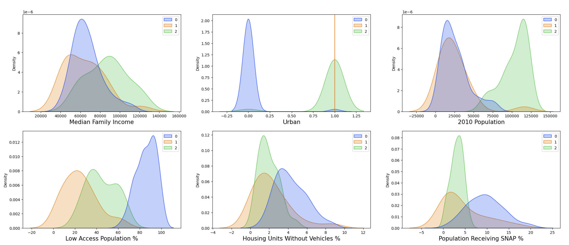
 Key feature distributions based on UMAP cluster. We found that cluster 0 was a food desert, 1 was a food swamp, and 2 was a food oasis.
Abstract
This project sought to address the problem of food insecurity in Virginia by classifying regions to help inform policy. The approach involved combining a dataset of Virginia food bank data with USDA’s Food Access Research Atlas, which contains data on food security. Early on, three distinct clusters of Virginia counties were discovered. The researchers found little success in linearly differentiating these clusters with a single metric, but were able to clearly distinguish them using a more holistic approach and feature analysis. These three clusters were called “food oasis”, “food swamp”, and “food desert”, which corroborated previous literature’s characterizations of such regions. Finally, the researchers were able to hand-select 9 features from the over 100 features, and use only these to predict which category a new region belonged to with 100% testing accuracy using a Deep Neural Network. With such a model, the researchers hope to better inform policy for both existing counties which have already been classified and new regions - whether in other states or in census tracts more local than counties - since food oases, food swamps, and food deserts should employ separate protocols to better suit their needs.
